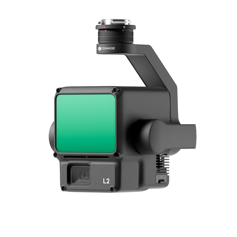
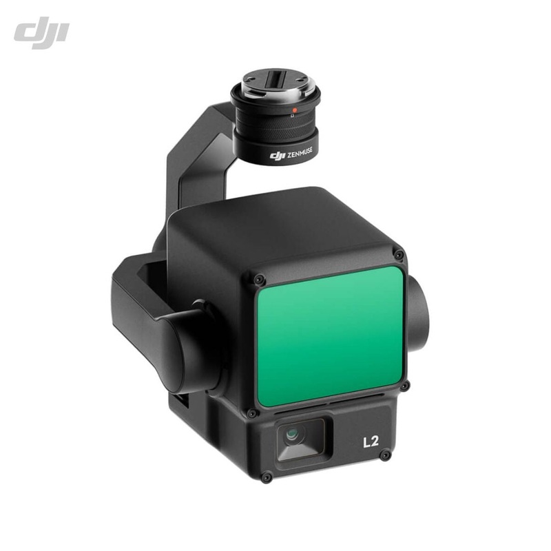
The DJI Zenmuse L2 integrates frame LiDAR, a self developed high accuracy IMU system, and a 4/3 CMOS RGB mapping camera, providing DJI platforms with more precise, efficient, and reliable geospatial data acquisition. When used with DJI Terra, it delivers a turnkey solution for 3D data collection and high accuracy post processing.
Supported by its powerful hardware, the L2 allows for a precise scan of complex subjects within an extended range and faster point cloud acquisition. During operations, users can preview, playback, and process point cloud models on-site, with Task Quality Reports generated by DJI Terra, offering a simple, one-stop solution to improve overall efficiency. This enables users to achieve high-precision point cloud results with one-stoppost-processing.
In both single and multiple return modes, the L2 can reach a max point cloud emission rate of 240,000 points per second, allowing the acquisition of more point cloud data in a giventime frame.
In coordination with DJI Enterprise flight platforms and DJI Terra, the Zenmuse L2 can be applied to land surveying and mapping, electrical, forestry, and infrastructure management, and a multitude of other scenarios.
Reviews
There are no reviews yet.